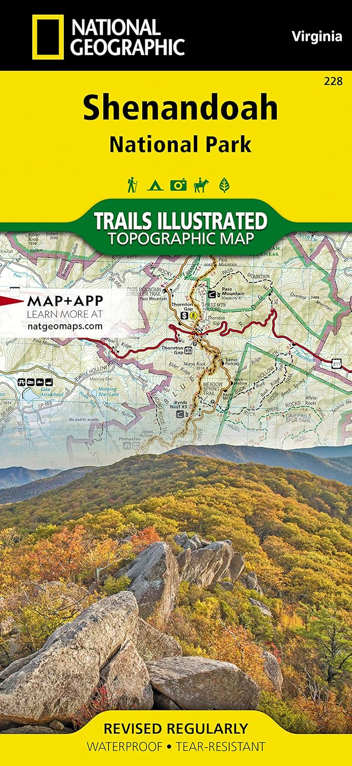
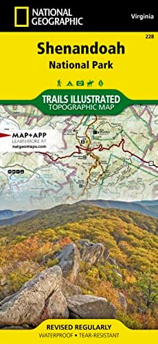
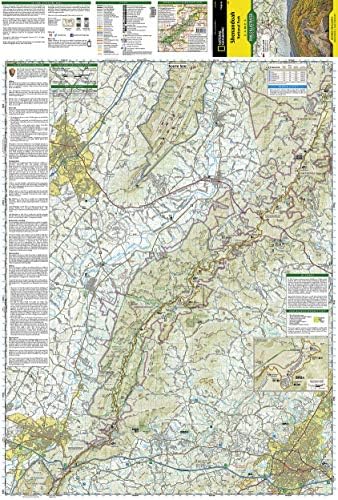
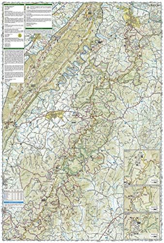
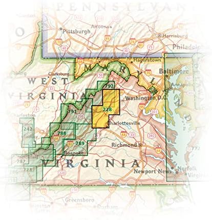
Shenandoah National Park Map (National Geographic Trails Illustrated Map, 228)
€0.00
66 in stock
- Satisfaction Guaranteed
- No Hassle Refunds
- Secure Payments
**Shenandoah National Park Map (National Geographic Trails Illustrated Map, 228)**
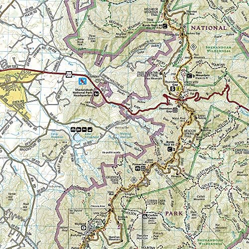
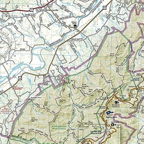
Discover the breathtaking beauty of Shenandoah National Park with the National Geographic Trails Illustrated Map, a must-have for outdoor enthusiasts and nature lovers alike. This expertly crafted map (228) provides detailed topographical coverage, ensuring you never miss a moment of adventure as you explore the park’s stunning landscapes.
**Key Features:**
– **Comprehensive Coverage:** This map offers an extensive view of Shenandoah National Park, highlighting all major trails, roads, and points of interest. Whether you’re planning a day hike, a multi-day backpacking trip, or simply a scenic drive along Skyline Drive, you’ll have all the essential information at your fingertips.
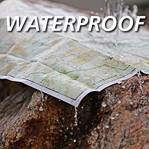
– **Durable and Waterproof:** Constructed with durable, waterproof materials, this map is designed to withstand the elements, ensuring you can rely on it in any weather condition. Perfect for your outdoor excursions, it won’t tear or disintegrate even in the wettest of conditions.
– **Trail Information:** With detailed descriptions of trails, including difficulty levels, distances, and elevation profiles, you can easily select the best routes to match your hiking skill and desired experience. The map also features highlights of key landmarks and natural features, enhancing your journey through this beautiful national park.
– **User-Friendly Design:** The map is laid out with clear, easy-to-read symbols and annotations, making navigation straightforward for both seasoned adventurers and novice hikers. The detailed legend provides essential information about amenities, camping sites, and safety guidelines.
– **Perfect for All Outdoor Activities:** Whether you’re hiking, biking, birdwatching, or simply soaking in the stunning views, this map serves as your essential companion for exploring Shenandoah National Park’s diverse ecosystems and wildlife.
– **Size:** Conveniently sized for easy handling and storage, the Shenandoah National Park Map fits perfectly in your backpack or pocket.
Embark on your next outdoor adventure with confidence. The Shenandoah National Park Map (National Geographic Trails Illustrated Map, 228) is the perfect tool to help you navigate the park’s enchanting trails and hidden gems. Get yours today and prepare for an unforgettable experience in one of America’s most beautiful national parks!
Related products
-
Optimus Wired GPS Tracker for Vehicles – Easy Installation on Car’s Battery – Low Cost Subscription Plan Options
Original price was: €29.95.€8.95Current price is: €8.95. -
Pisgah Ranger District Map [Pisgah National Forest] (National Geographic Trails Illustrated Map, 780)
Original price was: €14.95.€13.90Current price is: €13.90. -
Vyncs – GPS Tracker for Vehicles, [No Monthly Fee], 4G LTE, Vehicle Location, Trip History, Driving Alerts, GeoFence, Fuel Economy, OBD Fault Codes, USA-Developed, Family or Fleets
Original price was: €89.99.€79.99Current price is: €79.99.


![Pisgah Ranger District Map [Pisgah National Forest] (National Geographic Trails Illustrated Map, 780)](https://zachhikes.com/wp-content/uploads/2025/09/pisgah-ranger-d_0-300x300.jpg)

![Vyncs - GPS Tracker for Vehicles, [No Monthly Fee], 4G LTE, Vehicle Location, Trip History, Driving Alerts, GeoFence, Fuel Economy, OBD Fault Codes, USA-Developed, Family or Fleets](https://zachhikes.com/wp-content/uploads/2025/09/vyncs-gps-tra_0-300x300.jpg)
